The data is licensed with the Creative Commons license
No alterations to the source data have been made, other than dynamic generalisation on the server to reduce download size.
Eircode lookups are done using the commercial Google maps API since Eircode do not provide any Open Data access similar to OSI.
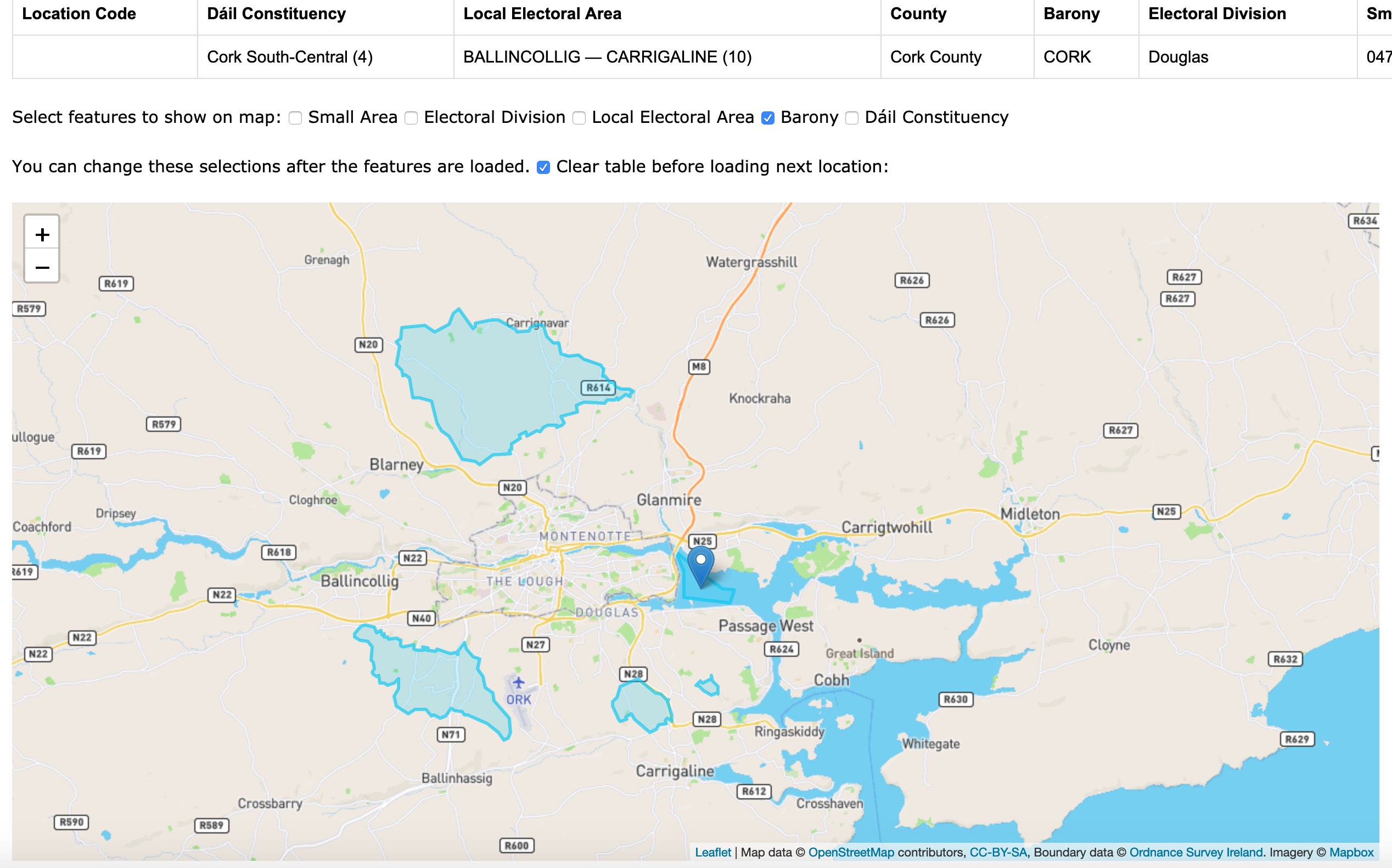
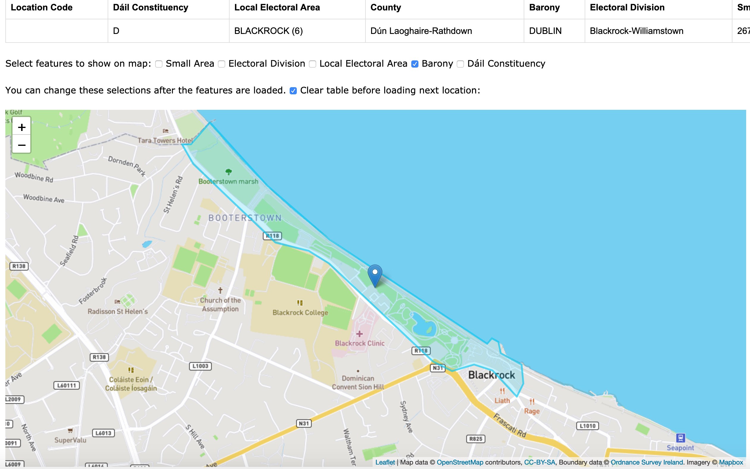
Baronies are not displayed in the legal cities (Dublin, Cork, Galway, Limerick). They are also not displayed in Waterford. This is a policy of the Ordnance Survey and possibly relates to the fact that the only administrative purpose for baronies is for property registration and only then outside of the cities.
This gives rise to some peculiar anomalies at the city boundaries. See, if you can find the barony of "Dublin" which is not the old barony of "Dublin city". It's just outside the boundary of Dublin city, but is very small. Also, the barony of Cork comprises a number of separate areas, including a section of Cork Harbour not connected to land.
If you can't find them, see the links below: